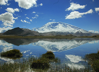
 Rising majestically on the Pamir Plateau in western Xinjiang, Muztagh Ata Mountain is one of the most famous snow mountains in China. With an elevation of 7,509 meters, Muztagh Ata is the second-highest peak among the mountains forming the northern edge of the Tibetan Plateau (not the second-highest mountain of the Tibetan Plateau itself).
The name Muztagh Ata comes from the Turkic language, meaning “Father of Ice Mountains.” Known for its relatively gentle western slopes and dry climate, the mountain is considered one of the more accessible 7,000-meter peaks in the world. However, successful climbing still requires careful acclimatization, excellent physical condition, and proper preparation.
Location and Geography of Muztagh Ata
Muztagh Ata is located south of Kongur Tagh, the highest peak of the Kunlun Mountains. Together, these two giant peaks form an isolated mountain group between the Pamir Mountains and the main Kunlun range.
Although Muztagh Ata is sometimes considered part of the Kunlun Mountains, its geographic connection is actually closer to the Pamirs. The mountain is often included within the region known as the Chinese Pamirs.
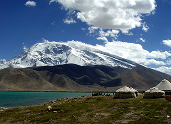
To the north and east lie the vast lowlands of the Tarim Basin and the Taklamakan Desert. The famous Karakoram Highway passes close to Muztagh Ata, offering travelers spectacular views of the mountain and nearby Karakul Lake.
The nearest town is Taxkorgan Tajik Autonomous County, the westernmost county in China, located near the border with Pakistan.
 A Famous Mountaineering Destination
Compared with many other 7,000-meter peaks, Muztagh Ata is considered relatively approachable because of its broad western slope and generally stable weather conditions. The standard climbing route follows the western ridge, which provides a gradual ascent compared with many technically challenging peaks.
However, the mountain’s high altitude, extreme cold, and unpredictable weather mean that climbers must have strong mountaineering skills and undergo sufficient acclimatization.
Climbing History of Muztagh Ata
The first recorded climbing attempt was made in 1894 by Swedish explorer and geographer Sven Hedin.
Further attempts followed in:
* 1900
* 1904
* 1947 – a British expedition led by Eric Shipton and Bill Tilman reached close to the summit but were forced to turn back due to severe cold and deep snow.
The first successful ascent took place in 1956, when a large Chinese-Russian expedition reached the summit via the western ridge. This route later became the standard climbing route.
Since then, Muztagh Ata has attracted climbers from around the world. Notable achievements include:
* 1980: An expedition led by Ned Gillette completed the first ski ascent and descent of a mountain above 7,500 meters.
* 2000: A more difficult southeast ridge route was successfully climbed.
* 2005: A new western-side route was completed.
* 2011: Swedish climber Anneli Wester completed a solo alpine-style ascent and spent a night on the summit.
Visiting Muztagh Ata
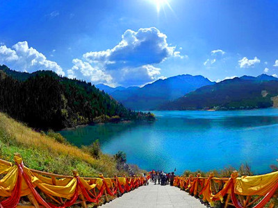
For travelers who are not climbing, Muztagh Ata is still one of the most spectacular natural attractions in Xinjiang. The best viewpoints are around Karakul Lake and along the Karakoram Highway, where visitors can admire:
* The snow-covered summit of Muztagh Ata
* Glaciers descending from the mountain
* Blue alpine lakes
* Vast Pamir Plateau landscapes
* Traditional Tajik villages nearby
With its dramatic scenery, mountaineering history, and legendary status among the world’s high peaks, Muztagh Ata is one of the most unforgettable destinations on the Kashgar–Pamir travel route.