search for a Trip
Article source: China Daily
-
There are many mountain ranges in China. Mountainous land and very rough terrains make up two-thirds of Chinese territory. From the Tibetan Plateau and other less-elevated highlands rise rugged east-west trending mountains. China's spectacular mountain landscapesattract the professional climber and wide-eyed adventurer alike.
The following are the "Top Ten Most Beautiful Mountains in China" rankedby China National Geography Magazine.
The criteria of China's Ten Most Beautiful Mountains are:
With unique well-worth appreciating value;
With the characteristics of that kind of geography shape and high scientific value;
Above 1000 meters in relative height, featured in the number and characteristics of vertical severity;
With high cultural values;
No excessive exploitation by humankind.
1. Namcha Barwa (Tibet)
Namcha Barwa or Namchabarwa is a mountain in the Tibetan Himalaya.
The traditional definition of the Himalaya extending from the IndusRiver to the Brahmaputra would make it the eastern anchor
of the entire mountain chain and its the highest peak of its own section as well as Earth's easternmost peak over 7,600 meters.
Best travel time: Feb-April and Oct-Nov

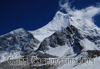
2. Mount Gongga (Sichuan)
Mount Gongga, also known as Minya Konka, is the highest mountain in Sichuan province. It is also known to locals as "The King
of SichuanMountains.” Situated in the Daxue Shan mountain range, between the Dadu River and Yalong River, part of the
Hengduan mountainousregion, Mount Gongga is the easternmost 7,000 meters (23,000 ft) peak in the world and the third
highest peak outside of theHimalaya/Karakoram, after Tirich Mir and Kongur Tagh. The peak has a large vertical relief over the
deep nearby gorges.
Best travel time: snows fall in later October and will melt in March
3. Mount Qomulangma (Tibet)
Mount Qomulangma (known as Mount Everest in the West) is the highest mountain on the planet. It is located in the Mahalangur
section ofthe Himalayas. Its peak is 8,848 metres (29,029 ft) above sea level and is the 5th furthest point from the center of Earth.
The internationalborder between China and Nepal runs across the precise summit point. Its massif includes neighboring
peaks Lhotse, 8,516 m (27,940 ft);Nuptse, 7,855 m (25,771 ft) and Changtse, 7,580 m (24,870 ft).
Best travel time: last ten days of April-first ten days of June, middle ten days of Sept-first ten days of October

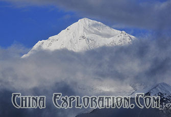
4. Meili Snow Mountain (Yunnan)
Meili Xue Shan or Mainri Snow Mountains is a mountain range in the Chinese province of Yunnan. They lie close to the
northwesternboundary of the province and are bounded by the Salween River on the west and the Mekong on the east.
The crest of the range rises toover 6,000 meters (20,000 ft) above sea level, making for impressive prominence over the river
valleys to the east and west, which arebetween 1,500 meters (4,900 ft) and 1,900 meters (6,200 ft) in elevation.
The highest peak is Kawagebo, which rises to 6,740 meters(22,110 ft). Kawagebo is considered sacred for Tibetan Buddhists.
Other significant peaks include Mianzimu, Peak 6509 and Jiariren-an.Because of restrictions and dangerous conditions, none of the major peaks in the range have ever been climbed.
Best travel time: Jan-May
5. Yellow Mountain (Anhui)
Huangshan or Yellow Mountain, is a mountain range in southern Anhui province in eastern China. The mountain range is
composed ofmaterial that was uplifted from an ancient sea during the Mesozoic era, 100 million years ago. The mountains themselves were carved byglaciers during the Quaternary.
Vegetation on the range is thickest below 1,100 meters (3,600 ft), with trees growing up to the treeline at1,800 meters (5,900 ft).
The area is well-known for its scenery, sunsets, peculiarly shaped granite peaks, Huangshan Pine trees, and views of the clouds fromabove.
Huangshan is a frequent subject of traditional Chinese paintings and literature, as well as modern photography.
It is a UNESCOWorld Heritage Site, and one of China's major tourist destinations.
Best travel time: 16 March-16 Nov
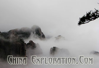

6. Three Holy Mountains in Daocheng (Sichuan)
Three Sacred Mountains is located in Daocheng County, Ganzi Tibetan Autonomous Prefecture of Sichuan Province. From the
meanderingranges, emerge the three sacred mountains of Daocheng: Xiannari, Yangmaiyong and Xianuoduoji. Since the
ancient times, the threesacred mountains have been a sacred place for Tibetan Buddhism.
Xiannairi, the main peak of the three sacred mountains with an altitude of 6032m, is first among Daocheng's high peaks.
According tolegend, it is the incarnation of the Buddhist Goddess of Mercy Guanyin or Avalokitesvara. Its slopes are vast;
its gradient gentle, themountain looks like Great Buddha sitting in peace, graceful and poised.
Best travel time: April-June and Sept-Nov
7. Chogori Peak (Xinjiang)
Chogori Peak, 8,611 meters in Yecheng County, Kashgar (Kashi) Region of Xinjiang Uygur Autonomous Region, is a transliteration of theTajik
language, meaning ''high, great and magnificent.'' Internationally, it is better known as K2, which is the only major mountain
in the worldthat has surveyor's notation as its common name (K stands for Karakoram, 2 means it was the second peak listed).
It is known as the Savage Mountain due to its extreme difficulty of ascent and has the second-highest fatality rate among the eight“thousanders.” For every four people who have reached the summit, one has died trying.
It is more difficult and hazardous to reach the peakof K2 from the Chinese side; thus, it is usually climbed from the Pakistani
side. Unlike Annapurna, the mountain with the highest fatality-to-summit rate, K2 has never been climbed in the winter.
Best travel time: July-Sept
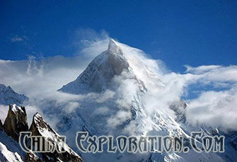

8. Mount Kailash (Tibet)
Mount Kailash (also Mount Kailas) is a peak in the Kailas Range (Gangdisê Mountains), which are part of the Transhimalaya in
Tibet. It liesnear the source of some of the longest rivers in Asia: the Indus River, the Sutlej River (a major tributary of the Indus
River), the BrahmaputraRiver, and the Karnali River (a tributary of the River Ganga). It is considered a sacred place in four
religions: Bön, Buddhism, Hinduism andJainism. The mountain lies near Lake Manasarovar and Lake Rakshastal in Tibet.
Best travel time: May-Oct
9. Mount Tai(Shangdong)
Mount Tai is a mountain of historical and cultural significance located north of the city of Tai'an, in Shandong province, China.
The tallestpeak is the Jade Emperor Peak which is commonly reported as 1,545 meters (5,069 ft) tall, but is described by the
PRC government as1,532.7 meters (5,029 ft).
Mount Tai is one of the "Five Great Mountains". It is associated with sunrises, birth, and renewal, and is often regarded the
foremost of thefive. It has been a place of worship for at least 3,000 years and served as one of the most important ceremonial
centers of China duringlarge portions of this period.
Best travel time: all year around
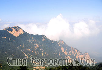
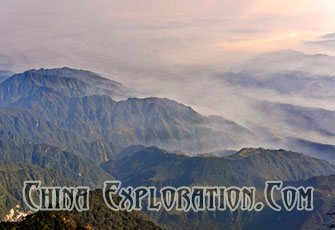
10. Mount Emei (Sichuan)
Mount Emei is located in Sichuan province, China. Typographically, Mt. Emei sits at the western rim of the Sichuan Basin.
The mountainswest of it are known as Daxiangling. A large surrounding area of countryside is geologically known as the
Permian Emeishan Large IgneousProvince, a large igneous province generated by the Emeishan Traps volcanic eruptions
during the Permian Period. At 3,099 meters(10,167 ft), Mt. Emei is the highest of the Four Sacred Buddhist Mountains of
China.
Best travel time: spring and autumn
- July 24th, 2014
More Attractions

